
Struthers topographic map
Interactive map
Click on the map to display elevation.
About this map
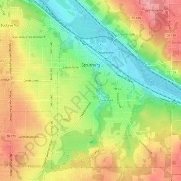
Name: Struthers topographic map, elevation, terrain.
Location: Struthers, Mahoning County, Ohio, 44471, United States (41.03081 -80.61590 41.06625 -80.56166)
Average elevation: 302 m
Minimum elevation: 248 m
Maximum elevation: 353 m