
Long Cay topographic map
Interactive map
Click on the map to display elevation.
About this map
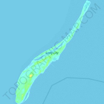
Name: Long Cay topographic map, elevation, terrain.
Location: Long Cay, Crooked Island and Long Cay, The Bahamas (22.54076 -74.38157 22.66734 -74.28199)
Average elevation: 0 m
Minimum elevation: -2 m
Maximum elevation: 20 m
Other topographic maps
Click on a map to view its topography, its elevation and its terrain.
Goat Cay
The Bahamas > Crooked Island and Long Cay
Goat Cay, Crooked Island and Long Cay, The Bahamas
Average elevation: 0 m
Cabbage Hill Settlement
The Bahamas > Crooked Island and Long Cay
Cabbage Hill Settlement, Crooked Island and Long Cay, The Bahamas
Average elevation: 7 m