
Ahimanu topographic map
Interactive map
Click on the map to display elevation.
About this map
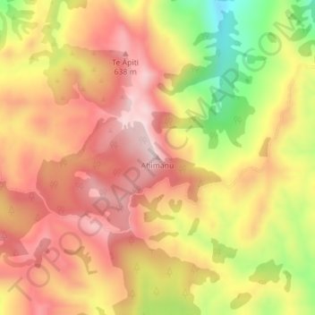
Name: Ahimanu topographic map, elevation, terrain.
Location: Ahimanu, Gisborne, New Zealand (-38.77392 177.62526 -38.77382 177.62536)
Average elevation: 519 m
Minimum elevation: 295 m
Maximum elevation: 663 m
Other topographic maps
Click on a map to view its topography, its elevation and its terrain.
Gisborne
New Zealand > Gisborne > Gisborne District
Gisborne, Gisborne District, Gisborne, 4010, New Zealand
Average elevation: 70 m