Geolocate

Polling topographic map

Click on the map to display elevation.

About this map
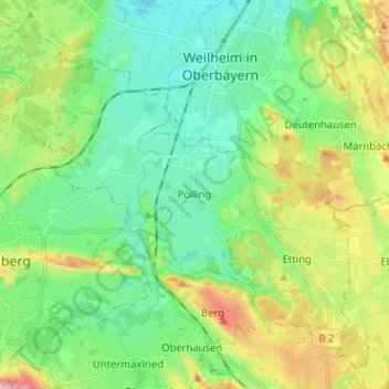
Name: Polling topographic map, elevation, terrain.

Location: Polling, Landkreis Weilheim-Schongau, Bavaria, 82398, Germany (47.77232 11.06250 47.84980 11.19044)

Average elevation: 594 m

Minimum elevation: 548 m

Maximum elevation: 696 m

Other topographic maps

Click on a map to view its topography, its elevation and its terrain.

Dessau

Germany > Bavaria > Landkreis Weilheim-Schongau > Burggen

Average elevation: 749 m

Fischen

Germany > Bavaria > Landkreis Weilheim-Schongau

Average elevation: 577 m

Tauting

Germany > Bavaria > Landkreis Weilheim-Schongau

Average elevation: 650 m

Gear up for your next adventure:

🌿Flora and Fauna Field Guides - Identify the plants and animals you encounter on your route
🔑Heavy Duty Carabiners - Secure gear to the outside of your pack for easy access
🔦LED Torches - LED torches for outdoor use
⛺Ultralight Solo Tents - Compact shelters for multi-day topographic surveying expeditions
🛠️Outdoor Repair Kits - Gear repair kits

As an Amazon Associate, this site earns from qualifying purchases at no extra cost to you.