
Thank you for supporting this site ❤️
Make a donation
Make a donation
Gear up for your next adventure:
As an Amazon Associate, this site earns from qualifying purchases at no extra cost to you.
Kedgwick topographic map
Click on the map to display elevation.
Thank you for supporting this site ❤️
Make a donation
Make a donation
Gear up for your next adventure:
As an Amazon Associate, this site earns from qualifying purchases at no extra cost to you.
About this map
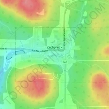
Name: Kedgwick topographic map, elevation, terrain.
Location: Kedgwick, Restigouche County, New Brunswick, E8B 1H2, Canada (47.63770 -67.36131 47.65133 -67.32489)
Average elevation: 291 m
Minimum elevation: 252 m
Maximum elevation: 339 m
Thank you for supporting this site ❤️
Make a donation
Make a donation
Gear up for your next adventure:
As an Amazon Associate, this site earns from qualifying purchases at no extra cost to you.