Geolocate

Cayuga topographic map

Click on the map to display elevation.

About this map
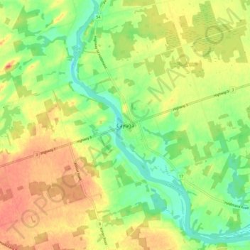
Name: Cayuga topographic map, elevation, terrain.

Location: Cayuga, Haldimand County, Ontario, N0A 1E0, Canada (42.90973 -79.89854 42.98973 -79.81854)

Average elevation: 196 m

Minimum elevation: 173 m

Maximum elevation: 217 m

Gear up for your next adventure:

🔪Outdoor Multi-tools - Versatile tools for gear repair and survival tasks in the wilderness
🔦Headlamps - Hands-free lighting for hiking
💡Collapsible Camping Lanterns - Illuminate your base camp or tent for map studying at night
🛌Sleeping Mats - Insulated mats for camping comfort
🦶Orthotic Hiking Insoles - Extra arch support for long-distance topographic treks

As an Amazon Associate, this site earns from qualifying purchases at no extra cost to you.