Geolocate

Angleton topographic map

Click on the map to display elevation.

About this map

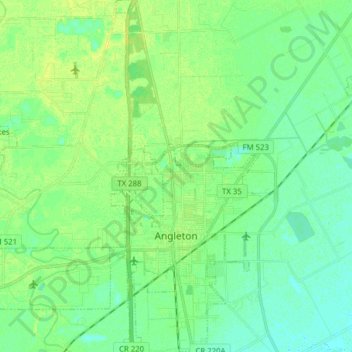
Name: Angleton topographic map, elevation, terrain.

Location: Angleton, Brazoria County, Texas, 77515, United States (29.12446 -95.46147 29.26063 -95.39317)

Average elevation: 9 m

Minimum elevation: 2 m

Maximum elevation: 18 m

Other topographic maps

Click on a map to view its topography, its elevation and its terrain.

Damon Mound

United States > Texas > Brazoria County > Damon

Average elevation: 28 m

Damon

United States > Texas > Brazoria County

Average elevation: 25 m

Damon

United States > Texas > Brazoria County

Average elevation: 25 m

Meridiana

United States > Texas > Brazoria County > Iowa Colony

Average elevation: 16 m

Rosharon

United States > Texas > Brazoria County

Average elevation: 16 m

Gear up for your next adventure:

🎒Hiking Backpacks - Backpacks designed for hiking and trekking
🎒40L Day Hiking Backpacks - Comfortable packs with hydration support for long days exploring topographic peaks
👄SPF Lip Balm - Prevent sun and wind-burnt lips on mountain ridges
📖Australian Bush Survival Books - Local knowledge on finding water and surviving the outback
📚Map Reading & Navigation Guides - Master the art of interpreting topographic contours and symbols

As an Amazon Associate, this site earns from qualifying purchases at no extra cost to you.