
Make a donation
Gear up for your next adventure:
As an Amazon Associate, this site earns from qualifying purchases at no extra cost to you.
Chlef topographic map
Click on the map to display elevation.
Make a donation
Gear up for your next adventure:
As an Amazon Associate, this site earns from qualifying purchases at no extra cost to you.
About this map
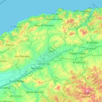
Name: Chlef topographic map, elevation, terrain.
Location: Chlef, Algeria (35.85122 0.69084 36.55563 1.72062)
Average elevation: 328 m
Minimum elevation: 0 m
Maximum elevation: 1,959 m
Make a donation
Gear up for your next adventure:
As an Amazon Associate, this site earns from qualifying purchases at no extra cost to you.
Other topographic maps
Click on a map to view its topography, its elevation and its terrain.
Bordj el Bahri Faizi
Algeria > Algiers > Dar El Beida District > Bordj El Bahri > Bordj el Bahri Faizi
Average elevation: 19 m
Make a donation
Gear up for your next adventure:
As an Amazon Associate, this site earns from qualifying purchases at no extra cost to you.