
Carretou topographic map
Interactive map
Click on the map to display elevation.
About this map
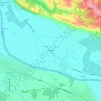
Name: Carretou topographic map, elevation, terrain.
Average elevation: 106 m
Minimum elevation: 79 m
Maximum elevation: 207 m
Other topographic maps
Click on a map to view its topography, its elevation and its terrain.
La Caussade
France > Occitanie > Tarn-et-Garonne > Corbarieu
La Caussade, Corbarieu, Montauban, Tarn-et-Garonne, Occitanie, France métropolitaine, 82370, France
Average elevation: 107 m