
Île Uvéa topographic map
Interactive map
Click on the map to display elevation.
About this map
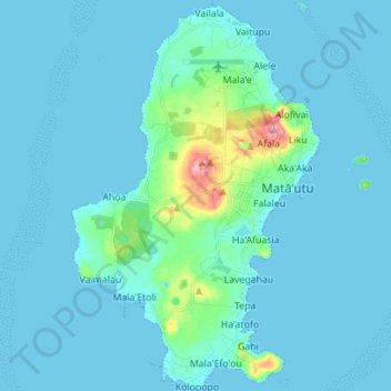
Name: Île Uvéa topographic map, elevation, terrain.
Location: Île Uvéa, Uvea, Wallis und Futuna, 98600, Frankreich (-13.35221 -176.25085 -13.21707 -176.16222)
Average elevation: 13 m
Minimum elevation: -1 m
Maximum elevation: 149 m