Deidesheim topographic map
Click on the map to display elevation.
Deidesheim
From a local climatic point of view, Deidesheim is part of the climatically favoured foothill zone of the Weinstraße region. With a mean elevation of 235 m above sea level at the forest's edge, the lands of the Deidesheim area reach down to some 130 m above sea level at the lower mid-slope area in the foothill zone. The outliers of the Madental and the Sensental, as well as those of the Einsteltal (dales) northwest of Deidesheim, form outflow pathways for the cold winds coming from the Haardt. Also affecting the local climate are small hollows and dells in which cold air can gather.
About this map
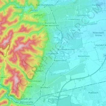
Name: Deidesheim topographic map, elevation, terrain.
Average elevation: 194 m
Minimum elevation: 98 m
Maximum elevation: 544 m
Other topographic maps
Click on a map to view its topography, its elevation and its terrain.