

Baldwin topographic map
Click on the map to display elevation.
Baldwin
According to the U.S. Census Bureau, the borough has a total area of 5.9 square miles (15 km2), of which 5.8 square miles (15 km2) is land and 0.1 square miles (0.26 km2) is water. Its average elevation is 1,214 feet (370 m) above sea level.
About this map

Name: Baldwin topographic map, elevation, terrain.
Average elevation: 338 m
Minimum elevation: 217 m
Maximum elevation: 397 m
Other topographic maps
Click on a map to view its topography, its elevation and its terrain.

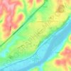
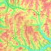
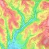
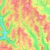
Keown Station
United States > Pennsylvania > Allegheny County > Ross Township
Average elevation: 344 m

Champion
United States > Pennsylvania > Allegheny County > North Fayette Township
Average elevation: 360 m


Glenmore Avenue Play Facility
United States > Pennsylvania > Allegheny County > West View
Average elevation: 340 m


Tortilla Flats
United States > Pennsylvania > Allegheny County > Sewickley Heights
Average elevation: 333 m
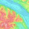

Mount Vernon
United States > Pennsylvania > Allegheny County > Elizabeth Township > Buena Vista
Average elevation: 299 m

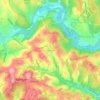
Coraopolis Heights
United States > Pennsylvania > Allegheny County > Findlay Township
Average elevation: 320 m
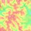
Central Highlands
United States > Pennsylvania > Allegheny County > Elizabeth Township
Average elevation: 327 m
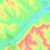
Sturgeon
United States > Pennsylvania > Allegheny County > North Fayette Township
Average elevation: 334 m


South Park
United States > Pennsylvania > Allegheny County > South Park Township > Library
Average elevation: 335 m


Woodland Park
United States > Pennsylvania > Allegheny County > Pittsburgh > Sharpe Hill
Average elevation: 303 m

Douglass
United States > Pennsylvania > Allegheny County > Elizabeth Township
Average elevation: 299 m

West Library
United States > Pennsylvania > Allegheny County > South Park Township > Library
Average elevation: 342 m

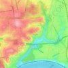
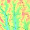
Highland Park Reservoir No. 2
United States > Pennsylvania > Allegheny County > Pittsburgh
Average elevation: 275 m
Allison Park
United States > Pennsylvania > Allegheny County > Hampton Township
Average elevation: 324 m
Neville Island
United States > Pennsylvania > Allegheny County > Neville Township
Average elevation: 289 m
Allegheny River Lock and Dam No. 2
United States > Pennsylvania > Allegheny County > O'Hara Township
Average elevation: 268 m
Cochrans Mill
United States > Pennsylvania > Allegheny County > Jefferson Hills
Average elevation: 311 m
Observatory Hill
United States > Pennsylvania > Allegheny County > Pittsburgh
Average elevation: 319 m
Stoneybrooke Woods
United States > Pennsylvania > Allegheny County > Cheswick
Average elevation: 283 m
Lovedale
United States > Pennsylvania > Allegheny County > Elizabeth Township
Average elevation: 298 m