
Zambezi topographic map
Interactive map
Click on the map to display elevation.
About this map
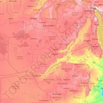
Name: Zambezi topographic map, elevation, terrain.
Location: Zambezi, 00236, Zimbabue (-18.62291 22.54314 -11.07455 36.46460)
Average elevation: 1,017 m
Minimum elevation: 0 m
Maximum elevation: 2,806 m
Other topographic maps
Click on a map to view its topography, its elevation and its terrain.
Mashonalandia Occidental
Zimbabue > Mashonalandia Occidental
Mashonalandia Occidental, Zimbabue
Average elevation: 971 m