
Erpeldange topographic map
Interactive map
Click on the map to display elevation.
About this map
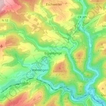
Name: Erpeldange topographic map, elevation, terrain.
Location: Erpeldange, Canton Wiltz, 9648, Luxemburg (49.95817 5.92775 49.99817 5.96775)
Average elevation: 379 m
Minimum elevation: 277 m
Maximum elevation: 524 m