
Lac Gareau topographic map
Interactive map
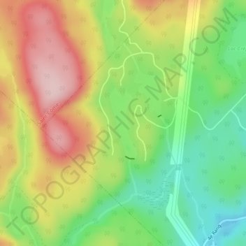
Click on the map to display elevation.
About this map
Name: Lac Gareau topographic map, elevation, terrain.
Average elevation: 364 m
Minimum elevation: 255 m
Maximum elevation: 488 m
Other topographic maps
Click on a map to view its topography, its elevation and its terrain.
Lac Dontigny
Canada > Québec > Saint-Alphonse-Rodriguez
Lac Dontigny, Rue Dontigny Nord, Lac-Rouge-Nord, Saint-Alphonse-Rodriguez, Matawinie, Lanaudière, Québec, Canada
Average elevation: 283 m
Lac Loyer
Canada > Québec > Saint-Alphonse-Rodriguez
Lac Loyer, 1e Rue Adam, Lac-Rouge-Nord, Saint-Alphonse-Rodriguez, Matawinie, Lanaudière, Québec, Canada
Average elevation: 270 m