Geolocate

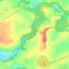
Lugton topographic map

Click on the map to display elevation.

About this map

Name: Lugton topographic map, elevation, terrain.

Location: Lugton, East Ayrshire, Scotland, KA3 4DY, United Kingdom (55.72429 -4.54890 55.76429 -4.50890)

Average elevation: 144 m

Minimum elevation: 90 m

Maximum elevation: 239 m

Other topographic maps

Click on a map to view its topography, its elevation and its terrain.

Braid Wood

United Kingdom > Scotland > East Ayrshire

Average elevation: 114 m

Glenbuck Loch

United Kingdom > Scotland > East Ayrshire

Average elevation: 327 m

Loch Doon

United Kingdom > Scotland > East Ayrshire

Average elevation: 291 m

River Doon

United Kingdom > Scotland > East Ayrshire > Dalrymple

Average elevation: 168 m

River Ayr

United Kingdom > Scotland > East Ayrshire

Average elevation: 210 m

Gear up for your next adventure:

⌚GPS Watches - GPS watches for outdoor sports
⌚Altimeter Barometer Watches - Outdoor watches with built-in sensors to track altitude changes and weather shifts
🩹First Aid Kits - Emergency kits for hiking
⌚Altimeter Watches - Watches with altitude tracking
🩹Blister Prevention Tape - Apply to friction points before they become painful sores

As an Amazon Associate, this site earns from qualifying purchases at no extra cost to you.