
River Falls topographic map
Interactive map
Click on the map to display elevation.
About this map
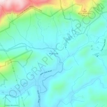
Name: River Falls topographic map, elevation, terrain.
Average elevation: 436 m
Minimum elevation: 321 m
Maximum elevation: 906 m
Other topographic maps
Click on a map to view its topography, its elevation and its terrain.
Dunean
United States > South Carolina > Greenville County > Chestnut Hills
Dunean, Chestnut Hills, Greenville County, South Carolina, United States
Average elevation: 292 m
Golden Grove
United States > South Carolina > Greenville County
Golden Grove, Greenville County, South Carolina, 29673, United States
Average elevation: 257 m