
Thank you for supporting this site ❤️
Make a donation
Make a donation
Gear up for your next adventure:
As an Amazon Associate, this site earns from qualifying purchases at no extra cost to you.
Sargans topographic map
Click on the map to display elevation.
Thank you for supporting this site ❤️
Make a donation
Make a donation
Gear up for your next adventure:
As an Amazon Associate, this site earns from qualifying purchases at no extra cost to you.
About this map
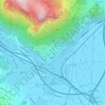
Name: Sargans topographic map, elevation, terrain.
Location: Sargans, Wahlkreis Sarganserland, St. Gallen, 7320, Switzerland (47.03988 9.41853 47.06885 9.47725)
Average elevation: 707 m
Minimum elevation: 472 m
Maximum elevation: 1,851 m
Thank you for supporting this site ❤️
Make a donation
Make a donation
Gear up for your next adventure:
As an Amazon Associate, this site earns from qualifying purchases at no extra cost to you.