
Sátão topographic map
Interactive map
Click on the map to display elevation.
About this map
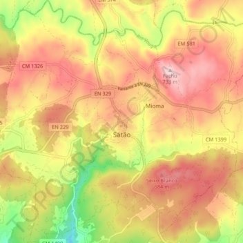
Name: Sátão topographic map, elevation, terrain.
Location: Sátão, Viseu, Viseu Dão-Lafões, Centro, Portugal (40.71511 -7.77551 40.77659 -7.72102)
Average elevation: 595 m
Minimum elevation: 413 m
Maximum elevation: 728 m