
Le Berbois topographic map
Interactive map
Click on the map to display elevation.
About this map
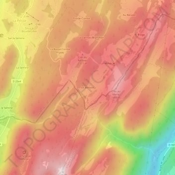
Name: Le Berbois topographic map, elevation, terrain.
Average elevation: 1,235 m
Minimum elevation: 687 m
Maximum elevation: 1,524 m
Other topographic maps
Click on a map to view its topography, its elevation and its terrain.
Sur la Semine
France > Bourgogne-Franche-Comté > Jura > La Pesse
Sur la Semine, La Pesse, Saint-Claude, Jura, Bourgogne-Franche-Comté, Metropolitan France, 39370, France
Average elevation: 1,192 m