
Thank you for supporting this site ❤️
Make a donation
Make a donation
Gear up for your next adventure:
As an Amazon Associate, this site earns from qualifying purchases at no extra cost to you.
Tiglietto topographic map
Click on the map to display elevation.
Thank you for supporting this site ❤️
Make a donation
Make a donation
Gear up for your next adventure:
As an Amazon Associate, this site earns from qualifying purchases at no extra cost to you.
About this map
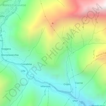
Name: Tiglietto topographic map, elevation, terrain.
Location: Tiglietto, Villanova, Ronco Canavese, Turin, Piedmont, Italy (45.47749 7.55099 45.49749 7.57099)
Average elevation: 1,174 m
Minimum elevation: 702 m
Maximum elevation: 2,069 m
Thank you for supporting this site ❤️
Make a donation
Make a donation
Gear up for your next adventure:
As an Amazon Associate, this site earns from qualifying purchases at no extra cost to you.