Geolocate

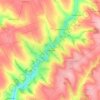
Yampil topographic map

Click on the map to display elevation.

About this map

Name: Yampil topographic map, elevation, terrain.

Location: Yampil, Yampil Urban Hromada, Mohyliv-Podilskyi Raion, Vinnytsia Oblast, 24500, Ukraine (48.22680 28.24494 48.27127 28.31492)

Average elevation: 109 m

Minimum elevation: 16 m

Maximum elevation: 181 m

Other topographic maps

Click on a map to view its topography, its elevation and its terrain.

Poval

Ukraine > Vinnytsia Oblast > Zhmerynka Raion

Average elevation: 307 m

Bershad

Ukraine > Vinnytsia Oblast

Average elevation: 182 m

Obodivka

Ukraine > Vinnytsia Oblast

Average elevation: 203 m

Babyntsi

Ukraine > Vinnytsia Oblast

Average elevation: 215 m

Horodkivka

Ukraine > Vinnytsia Oblast

Average elevation: 237 m

Chahiv

Ukraine > Vinnytsia Oblast

Average elevation: 255 m

Krykivtsi

Ukraine > Vinnytsia Oblast

Average elevation: 270 m

Gear up for your next adventure:

🥾Hiking Boots - Durable hiking boots for trails and rough terrain
🍳Ultralight Camping Stoves - Boil water quickly for meals using minimal fuel
🧢Outdoor Sun Hats - Sun protection hats for hiking
🩹Blister Prevention Tape - Apply to friction points before they become painful sores
🎽Hiking Clothing - Breathable clothing for hiking

As an Amazon Associate, this site earns from qualifying purchases at no extra cost to you.