
Lebosende topographic map
Interactive map
Click on the map to display elevation.
About this map
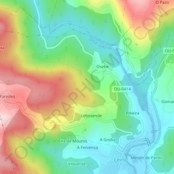
Name: Lebosende topographic map, elevation, terrain.
Location: Lebosende, Leiro, O Ribeiro, Ourense, Galicia, 32428, Spain (42.37152 -8.14954 42.39128 -8.11793)
Average elevation: 207 m
Minimum elevation: 83 m
Maximum elevation: 415 m