
Kotor topographic map
Interactive map
Click on the map to display elevation.
About this map
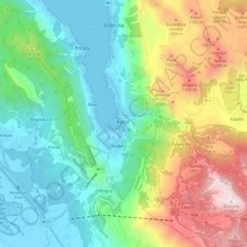
Name: Kotor topographic map, elevation, terrain.
Location: Kotor, Municipalité de Kotor, 85339, Monténégro (42.38425 18.73127 42.46425 18.81127)
Average elevation: 567 m
Minimum elevation: -1 m
Maximum elevation: 1,737 m