
Lamalonga topographic map
Interactive map
Click on the map to display elevation.
About this map
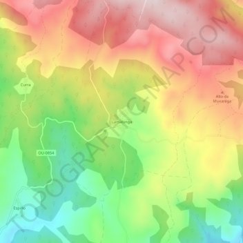
Name: Lamalonga topographic map, elevation, terrain.
Location: Lamalonga, La Vega, Valdeorras, Orense, Galicia, 32366, España (42.25932 -6.98467 42.29932 -6.94467)
Average elevation: 1,205 m
Minimum elevation: 992 m
Maximum elevation: 1,412 m
Other topographic maps
Click on a map to view its topography, its elevation and its terrain.
Meixide
España > Galicia > Valdeorras > La Vega
Meixide, La Vega, Valdeorras, Orense, Galicia, 32366, España
Average elevation: 1,171 m
As Touzas da Azoreira
España > Galicia > Valdeorras > La Vega
As Touzas da Azoreira, Meixide, La Vega, Valdeorras, Orense, Galicia, 32336, España
Average elevation: 1,398 m