
Ennepe topographic map
Interactive map
Click on the map to display elevation.
About this map
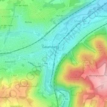
Name: Ennepe topographic map, elevation, terrain.
Average elevation: 224 m
Minimum elevation: 146 m
Maximum elevation: 366 m
Other topographic maps
Click on a map to view its topography, its elevation and its terrain.
Börkey
Deutschland > Nordrhein-Westfalen > Gevelsberg > Börkey
Börkey, Gevelsberg, Ennepe-Ruhr-Kreis, Nordrhein-Westfalen, 58285, Deutschland
Average elevation: 215 m