
羅娜村 topographic map
Interactive map
Click on the map to display elevation.
About this map
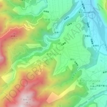
Name: 羅娜村 topographic map, elevation, terrain.
Location: 羅娜村, 羅娜 Luluna, Comté de Nantou, 臺灣省, Taïwan (23.60722 120.85056 23.64722 120.89056)
Average elevation: 986 m
Minimum elevation: 616 m
Maximum elevation: 1,603 m