Geolocate

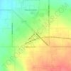
Rogerson topographic map

Click on the map to display elevation.

About this map

Name: Rogerson topographic map, elevation, terrain.

Location: Rogerson, Twin Falls County, Idaho, United States (42.19797 -114.61420 42.23797 -114.57420)

Average elevation: 1,498 m

Minimum elevation: 1,462 m

Maximum elevation: 1,552 m

Other topographic maps

Click on a map to view its topography, its elevation and its terrain.

Twin Falls

United States > Idaho > Twin Falls County

Average elevation: 1,138 m

Twin Falls

United States > Idaho > Twin Falls County

Average elevation: 1,138 m

Buhl

United States > Idaho > Twin Falls County

Average elevation: 1,149 m

Twin Falls

United States > Idaho > Twin Falls County

Average elevation: 1,138 m

Gear up for your next adventure:

🦯Trekking Poles - Walking poles for hiking stability
🧤Thermal Hiking Gloves - Keep your hands warm and functional during high-altitude winter treks
🔭Compact Hiking Binoculars - Lightweight optics for scouting routes or birdwatching
📕Australia Maps - Maps covering Australian regions
📕Hiking Guide Books - Guides for hiking trails

As an Amazon Associate, this site earns from qualifying purchases at no extra cost to you.