

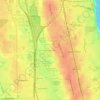
Mundelein topographic map
Click on the map to display elevation.
Mundelein
Mundelein is located 33 miles (53 km) northwest of the Chicago Loop. The area of the village is 10.12 square miles (26.2 km2), 0.45 square miles (1.2 km2) of which is water. The elevation of the village is 742 feet (226 m). Mundelein borders Hawthorn Woods and Vernon Hills to the south and east, and is primarily located within the Indian Creek watershed in Lake County.
About this map
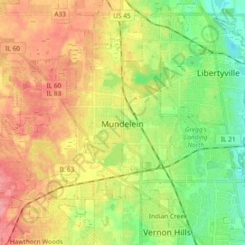
Name: Mundelein topographic map, elevation, terrain.
Location: Mundelein, Lake County, Illinois, 60060, United States (42.22754 -88.06818 42.29962 -87.93859)
Average elevation: 231 m
Minimum elevation: 193 m
Maximum elevation: 271 m
Other topographic maps
Click on a map to view its topography, its elevation and its terrain.

Illinois Beach State Park
United States > Illinois > Lake County
The park is located in the 12 mile long Zion Beach Ridge Plain. The Zion Beach Ridge Plain is 3,700 years old and composed of curvilinear ridge-and-swale topography. The beach ridges support black oak savanna habitat, while wetlands dominate the swales. The Zion Beach Ridge Plain has been migrating south…
Average elevation: 178 m


Lake Naomi
United States > Illinois > Lake County > Hawthorn Woods > White Birch Lakes
Average elevation: 261 m