
Thank you for supporting this site ❤️
Make a donation
Make a donation
Gear up for your next adventure:
As an Amazon Associate, this site earns from qualifying purchases at no extra cost to you.
Brignole topographic map
Click on the map to display elevation.
Thank you for supporting this site ❤️
Make a donation
Make a donation
Gear up for your next adventure:
As an Amazon Associate, this site earns from qualifying purchases at no extra cost to you.
About this map
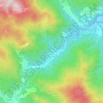
Name: Brignole topographic map, elevation, terrain.
Location: Brignole, Rezzoaglio, Genoa, Liguria, 16048, Italy (44.49839 9.34920 44.53839 9.38920)
Average elevation: 951 m
Minimum elevation: 673 m
Maximum elevation: 1,410 m
Thank you for supporting this site ❤️
Make a donation
Make a donation
Gear up for your next adventure:
As an Amazon Associate, this site earns from qualifying purchases at no extra cost to you.