Geolocate

Yama topographic map

Click on the map to display elevation.

About this map

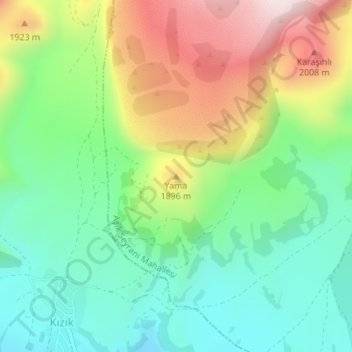
Name: Yama topographic map, elevation, terrain.

Location: Yama, Develi, Central Anatolia Region, Turkey (38.45001 35.41050 38.45011 35.41060)

Average elevation: 1,771 m

Minimum elevation: 1,571 m

Maximum elevation: 2,111 m

Gear up for your next adventure:

📡Satellite Messengers - Emergency communication devices
🧰Survival Kits - Essential survival gear
👟Lightweight Trail Runners - Agile footwear for fast movement over rugged Australian terrain
🧼Clip-on Hand Sanitizer - Maintain hygiene when water for washing is scarce
🧥Insulated Down Jackets - High warmth-to-weight ratio for cold nights in the high country

As an Amazon Associate, this site earns from qualifying purchases at no extra cost to you.