
Penobscot County topographic map
Interactive map
Click on the map to display elevation.
About this map
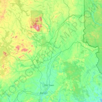
Name: Penobscot County topographic map, elevation, terrain.
Location: Penobscot County, Maine, Verenigde Staten van Amerika (44.64406 -69.35566 46.39576 -67.93916)
Average elevation: 193 m
Minimum elevation: -2 m
Maximum elevation: 1,571 m
Other topographic maps
Click on a map to view its topography, its elevation and its terrain.
Bangor
Verenigde Staten van Amerika > Maine > Bangor
Bangor, Penobscot County, Maine, Verenigde Staten van Amerika
Average elevation: 42 m