
Barrancas topographic map
Interactive map
Click on the map to display elevation.
About this map
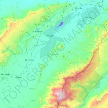
Name: Barrancas topographic map, elevation, terrain.
Location: Barrancas, La Guajira, Colombia (10.82002 -72.91103 11.13653 -72.48152)
Average elevation: 451 m
Minimum elevation: -59 m
Maximum elevation: 2,189 m
Other topographic maps
Click on a map to view its topography, its elevation and its terrain.