Geolocate

McCullough topographic map

Click on the map to display elevation.

About this map
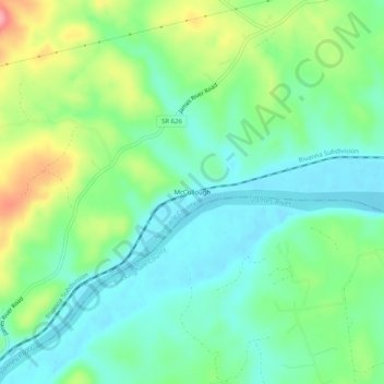
Name: McCullough topographic map, elevation, terrain.

Location: McCullough, Albemarle County, Virginia, United States (37.73709 -78.63529 37.77709 -78.59529)

Average elevation: 123 m

Minimum elevation: 87 m

Maximum elevation: 202 m

Other topographic maps

Click on a map to view its topography, its elevation and its terrain.

Crozet

United States > Virginia > Albemarle County > Crozet

Average elevation: 208 m

Keswick

United States > Virginia > Albemarle County > Keswick

Average elevation: 127 m

Rio

United States > Virginia > Albemarle County > Rio

Average elevation: 149 m

Hollymead

United States > Virginia > Albemarle County > Hollymead

Average elevation: 149 m

Rio

United States > Virginia > Albemarle County > Rio

Average elevation: 149 m

Scottsville

United States > Virginia > Albemarle County

Average elevation: 115 m

Crozet

United States > Virginia > Albemarle County > Crozet

Average elevation: 208 m

Ivy

United States > Virginia > Albemarle County

Average elevation: 187 m

Rio

United States > Virginia > Albemarle County > Rio

Average elevation: 149 m

Lake

United States > Virginia > Albemarle County > Hollymead

Average elevation: 151 m

Gear up for your next adventure:

⌚Altimeter Barometer Watches - Outdoor watches with built-in sensors to track altitude changes and weather shifts
☕Outdoor Coffee Makers - Enjoy quality coffee at the summit of your favorite peak
🧢Wide Brim Sun Hats - Maximum coverage for the face and neck while out in the open
⌚Altimeter Watches - Watches with altitude tracking
🎒Daypacks - Compact backpacks for short hikes

As an Amazon Associate, this site earns from qualifying purchases at no extra cost to you.