Geolocate

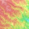
Occoquan topographic map

Click on the map to display elevation.

About this map

Name: Occoquan topographic map, elevation, terrain.

Location: Occoquan, Prince William County, Virginia, 22125, United States (38.67753 -77.26651 38.68781 -77.25414)

Average elevation: 42 m

Minimum elevation: -5 m

Maximum elevation: 88 m

Other topographic maps

Click on a map to view its topography, its elevation and its terrain.

Antioch

United States > Virginia > Prince William County

Average elevation: 199 m

Gear up for your next adventure:

🧤Hiking Gloves - Protective gloves for outdoor use
🚴Bike GPS - GPS devices for cycling
🧤Thermal Hiking Gloves - Keep your hands warm and functional during high-altitude winter treks
⌚Altimeter Watches - Watches with altitude tracking
🥾Heavy Duty Hiking Boots - Ankle-supporting boots for carrying heavy packs on steep contours

As an Amazon Associate, this site earns from qualifying purchases at no extra cost to you.