
Redwood County topographic map
Interactive map
Click on the map to display elevation.
About this map
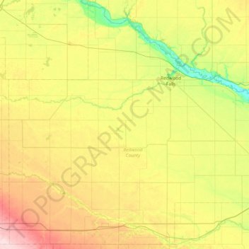
Name: Redwood County topographic map, elevation, terrain.
Location: Redwood County, Minnesota, VS (44.19644 -95.59384 44.69869 -94.86220)
Average elevation: 326 m
Minimum elevation: 248 m
Maximum elevation: 448 m
Other topographic maps
Click on a map to view its topography, its elevation and its terrain.
Minneapolis
VS > Minnesota > Minneapolis
Minneapolis, Hennepin County, Minnesota, VS
Average elevation: 270 m