Geolocate

Bangbang topographic map

Click on the map to display elevation.

About this map

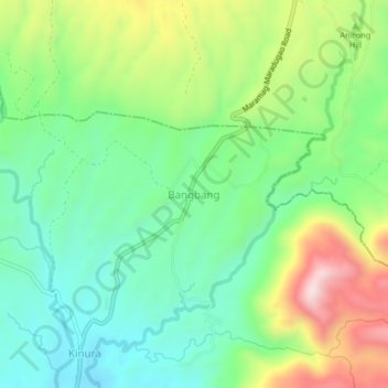
Name: Bangbang topographic map, elevation, terrain.

Location: Bangbang, Kalilangan, Bukidnon, Northern Mindanao, Philippines (7.77928 124.74651 7.81928 124.78651)

Average elevation: 719 m

Minimum elevation: 536 m

Maximum elevation: 1,065 m

Gear up for your next adventure:

🔋Solar Power Banks - Charge your phone and GPS using the sun while deep in the bush
🦟Insect Repellent - Protection against insects
🏃Compression Recovery Socks - Reduce leg fatigue after heavy days of elevation gain
🎒Hiking Backpacks - Backpacks designed for hiking and trekking
🌿Flora and Fauna Field Guides - Identify the plants and animals you encounter on your route

As an Amazon Associate, this site earns from qualifying purchases at no extra cost to you.