
Portage Glacier topographic map
Interactive map
Click on the map to display elevation.
About this map
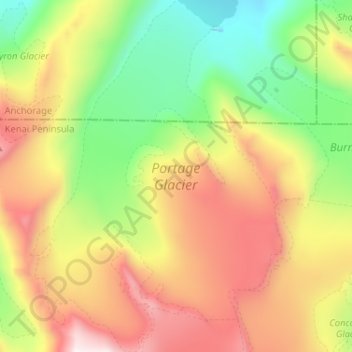
Name: Portage Glacier topographic map, elevation, terrain.
Average elevation: 836 m
Minimum elevation: 204 m
Maximum elevation: 1,657 m
Other topographic maps
Click on a map to view its topography, its elevation and its terrain.
Wonder Park
United States of America > Alaska > Anchorage > Wonder Park
Wonder Park, Anchorage, Alaska, 99598, United States of America
Average elevation: 57 m