Geolocate

Little Bay topographic map

Interactive map

Click on the map to display elevation.

About this map

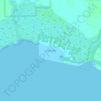
Name: Little Bay topographic map, elevation, terrain.

Location: Little Bay, Mobile County, Alabama, 86082, United States (30.38626 -88.28394 30.38636 -88.28384)

Average elevation: 1 m

Minimum elevation: -3 m

Maximum elevation: 5 m

Other topographic maps

Click on a map to view its topography, its elevation and its terrain.

Theodore

United States > Alabama > Mobile County > Theodore

Average elevation: 24 m

Mobile

United States > Alabama > Mobile County > Mobile

Mobile is located in the southwestern corner of the U.S. state of Alabama. According to the United States Census Bureau, the city has a total area of 159.4 square miles (413 km2), with 117.9 square miles (305 km2) of it being land, and 41.5 square miles (107.5 km2), or 26.1% of the total, being covered by…

Average elevation: 14 m