
Urkiaga topographic map
Interactive map
Click on the map to display elevation.
About this map
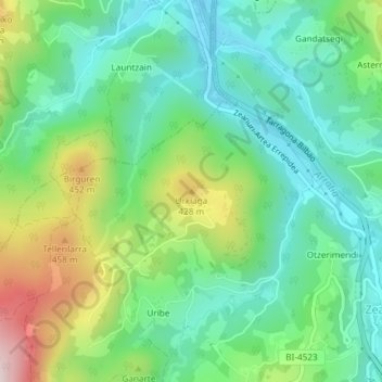
Name: Urkiaga topographic map, elevation, terrain.
Location: Urkiaga, Ceánuri, Vizcaya, País Vasco, 48148, España (43.10674 -2.76837 43.10684 -2.76827)
Average elevation: 273 m
Minimum elevation: 134 m
Maximum elevation: 580 m
Other topographic maps
Click on a map to view its topography, its elevation and its terrain.
Gorbea
España > País Vasco > Ceánuri
Gorbea, Zuya, Estribaciones del Gorbea, Álava, País Vasco, España
Average elevation: 1,189 m
Humedal Saldropo
España > País Vasco > Ceánuri
Humedal Saldropo, Ceánuri, Vizcaya, País Vasco, 48148, España
Average elevation: 619 m
Ceánuri
España > País Vasco > Ceánuri > Ceánuri
Ceánuri, Arratia-Nervión, Vizcaya, País Vasco, 48148, España
Average elevation: 633 m