
Vatra Dornei topographic map
Interactive map
Click on the map to display elevation.
About this map
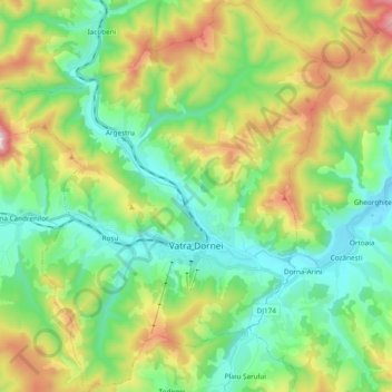
Name: Vatra Dornei topographic map, elevation, terrain.
Location: Vatra Dornei, Suceava, Romania (47.29874 25.24439 47.42757 25.41889)
Average elevation: 1,013 m
Minimum elevation: 769 m
Maximum elevation: 1,545 m
Other topographic maps
Click on a map to view its topography, its elevation and its terrain.