
Murud Akola topographic map
Interactive map
Click on the map to display elevation.
About this map
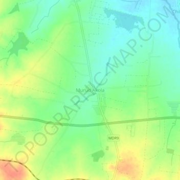
Name: Murud Akola topographic map, elevation, terrain.
Location: Murud Akola, Latur, Maharashtra, 413511, India (18.37893 76.38668 18.41893 76.42668)
Average elevation: 644 m
Minimum elevation: 625 m
Maximum elevation: 668 m