
Gonzales topographic map
Interactive map
Click on the map to display elevation.
About this map
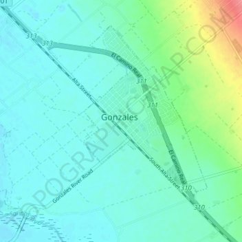
Name: Gonzales topographic map, elevation, terrain.
Location: Gonzales, Monterey County, California, 93926, USA (36.48768 -121.48448 36.52678 -121.42196)
Average elevation: 47 m
Minimum elevation: 32 m
Maximum elevation: 108 m