
Make a donation
Gear up for your next adventure:
As an Amazon Associate, this site earns from qualifying purchases at no extra cost to you.
Neuses an der Regnitz topographic map
Click on the map to display elevation.
Make a donation
Gear up for your next adventure:
As an Amazon Associate, this site earns from qualifying purchases at no extra cost to you.
About this map
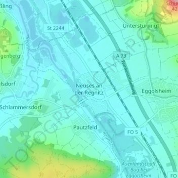
Name: Neuses an der Regnitz topographic map, elevation, terrain.
Average elevation: 266 m
Minimum elevation: 245 m
Maximum elevation: 393 m
Make a donation
Gear up for your next adventure:
As an Amazon Associate, this site earns from qualifying purchases at no extra cost to you.
Other topographic maps
Click on a map to view its topography, its elevation and its terrain.
Forchheim
Germany > Bavaria > Landkreis Forchheim
Forchheim (German pronunciation: [ˈfɔʁçhæɪ̯m] ) is a town in Upper Franconia (German: Oberfranken) in northern Bavaria, and also the seat of the administrative district of Forchheim. Forchheim is a former royal city, and is sometimes called the Gateway to the Franconian Switzerland, referring to the…
Average elevation: 299 m
Gräfenberg
Germany > Bavaria > Landkreis Forchheim
Gräfenberg is located in the southern part of Little Switzerland. The town is characterised by a great range of elevation (from 400 to 550 metres). A brook, the Kalkach, flows through the town with a steep drop.
Average elevation: 468 m
Make a donation
Gear up for your next adventure:
As an Amazon Associate, this site earns from qualifying purchases at no extra cost to you.
Make a donation
Gear up for your next adventure:
As an Amazon Associate, this site earns from qualifying purchases at no extra cost to you.
Make a donation
Gear up for your next adventure:
As an Amazon Associate, this site earns from qualifying purchases at no extra cost to you.