
Thum topographic map
Interactive map
Click on the map to display elevation.
About this map
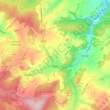
Name: Thum topographic map, elevation, terrain.
Location: Thum, Erzgebirgskreis, Sachsen, 09419, Deutschland (50.65169 12.90124 50.70099 13.00044)
Average elevation: 564 m
Minimum elevation: 404 m
Maximum elevation: 720 m
Other topographic maps
Click on a map to view its topography, its elevation and its terrain.
Wilisch
Deutschland > Sachsen > Erzgebirgskreis > Thum
Wilisch, Venusberg, Thum, Erzgebirgskreis, Sachsen, 09419, Deutschland
Average elevation: 494 m