Geolocate

CocoCay topographic map

Click on the map to display elevation.

About this map

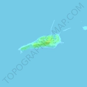
Name: CocoCay topographic map, elevation, terrain.

Location: CocoCay, Berry Islands, Bahamas (25.81409 -77.94848 25.82076 -77.93235)

Average elevation: 0 m

Minimum elevation: 0 m

Maximum elevation: 12 m

Other topographic maps

Click on a map to view its topography, its elevation and its terrain.

Great Stirrup Cay

Bahamas > Berry Islands

Average elevation: 1 m

Great Stirrup Cay

Bahamas > Berry Islands

Average elevation: 1 m

Gear up for your next adventure:

💡Collapsible Camping Lanterns - Illuminate your base camp or tent for map studying at night
🏕️Camping Gear - Essential camping equipment
🛌Sleeping Bags - Sleeping bags for outdoor camping
🔥Camping Stoves - Portable stoves for outdoor cooking
📡Portable Emergency Radios - Stay informed about weather warnings and bushfire alerts

As an Amazon Associate, this site earns from qualifying purchases at no extra cost to you.