
Sao Vàng topographic map
Interactive map
Click on the map to display elevation.
About this map
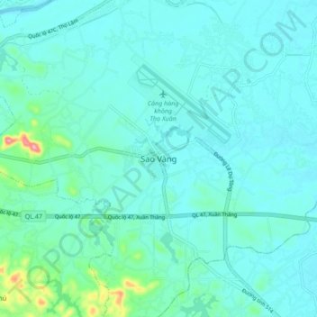
Name: Sao Vàng topographic map, elevation, terrain.
Location: Sao Vàng, Thọ Xuân, Province de Thanh Hóa, Viêt Nam (19.84793 105.42173 19.92793 105.50173)
Average elevation: 27 m
Minimum elevation: 6 m
Maximum elevation: 165 m