Geolocate

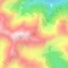
Stillwater topographic map

Click on the map to display elevation.

About this map

Name: Stillwater topographic map, elevation, terrain.

Location: Stillwater, Grey District, West Coast, New Zealand (-42.45720 171.33282 -42.41720 171.37282)

Average elevation: 96 m

Minimum elevation: 10 m

Maximum elevation: 567 m

Other topographic maps

Click on a map to view its topography, its elevation and its terrain.

Arnold River

New Zealand > West Coast > Grey District > Moana

Average elevation: 153 m

Lake Haupiri

New Zealand > West Coast > Grey District

Average elevation: 223 m

Lake Avernus

New Zealand > West Coast > Grey District

Average elevation: 1,335 m

Gear up for your next adventure:

🧭Global Orienteering Compass - High-precision liquid-filled compasses for accurate map reading and navigation
🧦Hiking Socks - Comfortable socks for long hikes
🎒40L Day Hiking Backpacks - Comfortable packs with hydration support for long days exploring topographic peaks
📡Satellite Messengers - Emergency communication devices
🧺Fast-Dry Microfiber Towels - Large towels that pack down to the size of an orange

As an Amazon Associate, this site earns from qualifying purchases at no extra cost to you.