
Gstaad topographic map
Interactive map
Click on the map to display elevation.
About this map
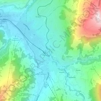
Name: Gstaad topographic map, elevation, terrain.
Average elevation: 1,242 m
Minimum elevation: 1,010 m
Maximum elevation: 1,922 m
Other topographic maps
Click on a map to view its topography, its elevation and its terrain.
Saanen
Switzerland > Bern > Obersimmental-Saanen administrative district
Saanen, Obersimmental-Saanen administrative district, Oberland administrative region, Bern, Switzerland
Average elevation: 1,526 m