
Pitcairn topographic map
Interactive map
Click on the map to display elevation.
About this map
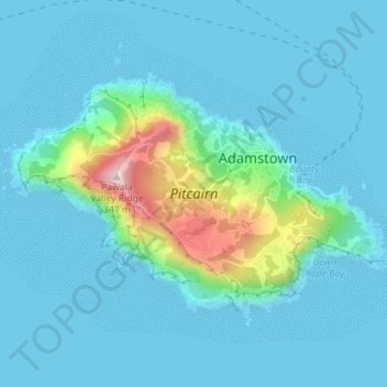
Name: Pitcairn topographic map, elevation, terrain.
Location: Pitcairn, Pitcairn Islands (-25.07972 -130.12299 -25.05955 -130.08774)
Average elevation: 45 m
Minimum elevation: -6 m
Maximum elevation: 326 m
Other topographic maps
Click on a map to view its topography, its elevation and its terrain.